

At JD Surveying we provide first class surveying and engineering services for our clients all over the South East of England and across the UK. We pride ourselves on our commitment to provide a professional and speedy service, whilst maintaining the highest quality of work. We have the experience and skills necessary to tackle just about every type of job that comes our way from small domestic work to larger commercial projects.
We can provide you with:
- Topographical Surveys
- Measured Building Surveys
- Site Engineering
- 3D Laser Scanning
- Drone Surveys
- and more
Please see below for more details.
What we do
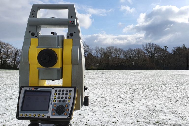
Topographical Surveys
We can carry out detailed topographical surveys, which includes mapping out and taking levels of the land. The depth of detail can be tailored to suit the requirements of our clients from acres of farmland to small domestic properties.
These are often used for planning permission, building development, updating land deeds or boundary disputes.
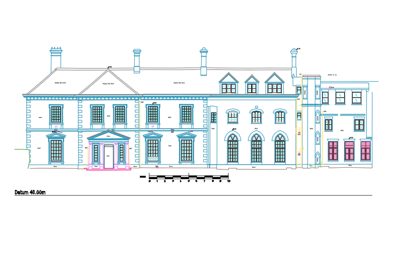
Measured Building Surveys
JD Surveying are able to provide accurate measured building surveys. These are used for a number of reasons including; building refurbishments, right of light issues, planning permission, record drawings.
We are able to produce elevation, floor plan and section drawings to any level of detail.
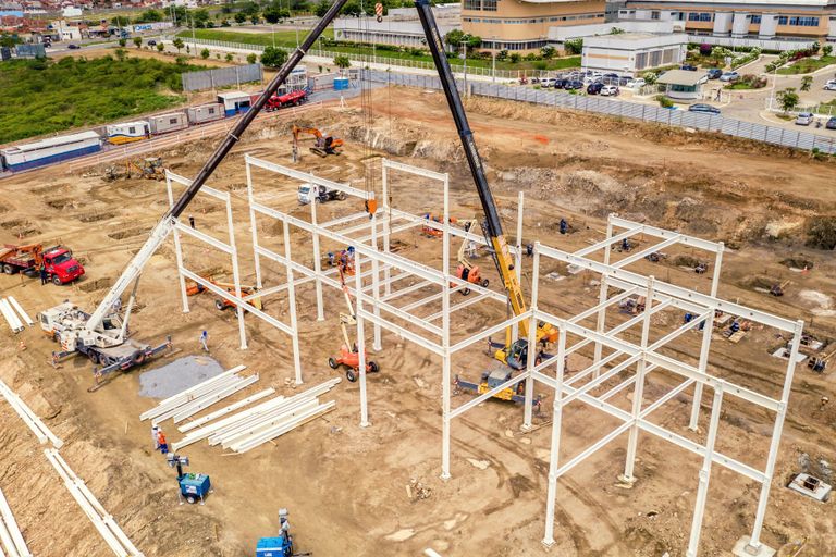
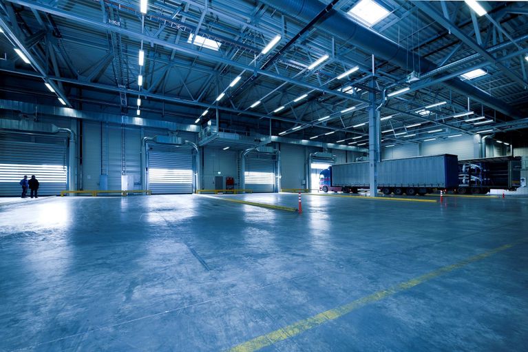
Site Engineering
We are able to establish site control, level datums and gridlines for any sized project. We can mark out the locations of any features from design drawings that are required for construction work to continue to progress.
This is carried out to millimetre accuracy therefore helping to ensure everything is build in the correct position.
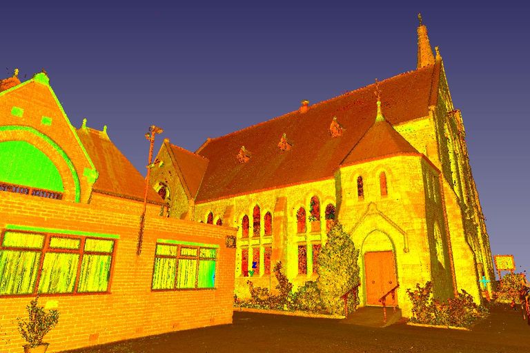
3D Laser Scanning
Using the latest laser scanner technology we are able to carry out 3D surveys, allowing us to precisely pick up every piece of detail.
These can be used to produce 3D point clouds or models, intricate elevational drawings, accurate section drawings and detailed floorplan drawings.

Drone Surveys (UAV)
With the use of state of the art drone equipment we can carry out aerial surveys. These are used for aerial imagery/video, topographical mapping of large areas, measured building surveys, 3D point clouds, volumetric surveys, or visual inspections.
As-built Surveys
We provide as-built surveys to give the accurate position of building elements as they may differ from the original design for record purposes and to help aid in future development.
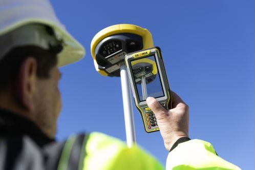
GPS Surveys
Our surveys can be carried out to OS National Grid (OSGB36) using the latest Geomax GNSS technology that gives an accurate position. We are also able to carry out surveys to a local grid.
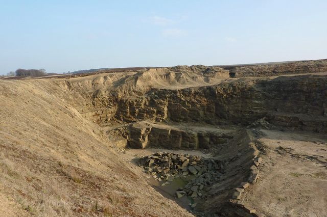
Volume Surveys
Utilising the latest software we are able to give you precise values to determine the volume of stockpiles or volume of fill needed.
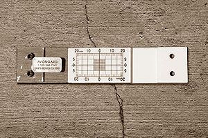
Monitoring
We can provide movement and crack monitoring for buildings or structures. We monitor for any movement while construction progresses and produce reports on the findings.